Lake Tanganyika: Facts, Location, Depth, Size, Map, and Fish
Lake Tanganyika is one of Africa’s most remarkable natural wonders and a must-visit destination for travelers seeking breathtaking scenery, rich biodiversity, and authentic cultural experiences. Stretching across Tanzania, Burundi, the Democratic Republic of the Congo, and Zambia, it is the world’s longest freshwater lake and the second-deepest after Lake Baikal. Formed millions of years ago within the East African Rift Valley, Lake Tanganyika is famous for its crystal-clear waters, dramatic mountain backdrops, and exceptional aquatic life, including hundreds of fish species found nowhere else on Earth. Beyond its ecological importance, the lake supports millions of people through fishing, transportation, and tourism, making it a vital resource for the surrounding communities.
For visitors, Lake Tanganyika offers an unforgettable mix of relaxation and adventure. Travelers can enjoy pristine sandy beaches, snorkeling and scuba diving in remarkably clear waters, sport fishing, kayaking, sunset cruises, and birdwatching along its picturesque shoreline. Popular lakeside destinations such as Kigoma in Tanzania also provide access to nearby attractions, including Gombe Stream National Park and Mahale Mountains National Park, where chimpanzee trekking creates an extraordinary wildlife experience. Whether you are planning a luxury safari, a honeymoon, or an off-the-beaten-path African holiday, Lake Tanganyika combines spectacular landscapes, unique wildlife, and warm local hospitality to deliver one of East Africa’s most rewarding travel experiences.
Discover Lake Tanganyika’s facts, location, depth, size, map, fish, and formation. Explore Africa’s longest freshwater lake and its unique biodiversity.
Lake Tanganyika Facts
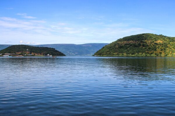
Lake Tanganyika is one of Africa’s most extraordinary natural landmarks and the world’s longest freshwater lake, stretching approximately 673 kilometers (418 miles). It is also the second-deepest freshwater lake on Earth, reaching a maximum depth of about 1,470 meters (4,820 feet). Located within the East African Rift Valley, the lake is shared by Tanzania, Burundi, the Democratic Republic of the Congo, and Zambia. It contains nearly 17% of the world’s available surface freshwater and supports millions of people through fishing, transport, and tourism. With more than 1,500 plant and animal species, many found nowhere else, Lake Tanganyika is a global biodiversity hotspot.
Lake Tanganyika Location
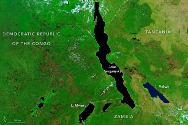
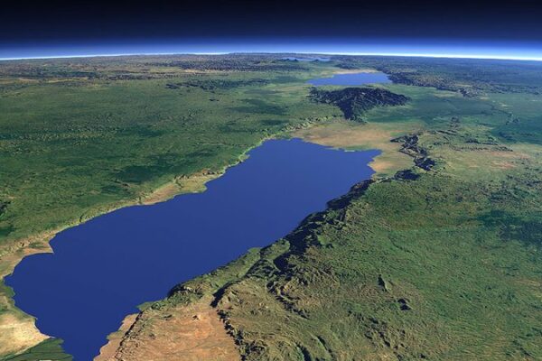
Lake Tanganyika lies in the western branch of the East African Rift Valley in East-Central Africa. It forms a natural border between four countries: Tanzania on the eastern shore, the Democratic Republic of the Congo on the western shore, Burundi to the north, and Zambia to the south. The lake stretches in a north-to-south direction through dramatic mountains and scenic escarpments, making it one of Africa’s most picturesque landscapes. Major lakeside towns include Kigoma in Tanzania, Bujumbura in Burundi, Kalemie in the Democratic Republic of the Congo, and Mpulungu in Zambia. Its strategic location makes it an important transportation and trade corridor.
Lake Tanganyika Depth
Lake Tanganyika is Africa’s deepest lake and the second-deepest freshwater lake in the world after Lake Baikal. Its deepest point reaches approximately 1,470 meters (4,820 feet), while the average depth is around 570 meters. Due to its immense depth, the lower layers contain very little oxygen, creating unique environmental conditions that support specialized aquatic life. Scientists consider the lake an important natural laboratory for studying climate history, evolution, and freshwater ecosystems. The enormous water volume also makes Lake Tanganyika one of the world’s largest freshwater reservoirs, storing enough water to sustain millions of people across four neighboring countries.
Lake Tanganyika Size
Lake Tanganyika covers an impressive surface area of approximately 32,900 square kilometers (12,700 square miles), making it one of Africa’s largest lakes by area and volume. The lake extends about 673 kilometers from north to south and averages around 50 kilometers in width, although some sections are much wider. It holds nearly 18,900 cubic kilometers of freshwater, representing a significant share of the planet’s accessible surface freshwater. Its vast shoreline stretches over 1,800 kilometers, supporting vibrant fishing communities, ports, beaches, wildlife habitats, and tourism destinations that contribute greatly to the regional economy.
Lake Tanganyika Map
A map of Lake Tanganyika highlights its long, narrow shape within the Western Rift Valley of East Africa. The lake spans four countries, Burundi, the Democratic Republic of the Congo, Tanzania, and Zambia, and serves as an important geographical landmark in the African Great Lakes region. Key rivers flowing into the lake include the Ruzizi, Malagarasi, and Kalambo Rivers, while the Lukuga River carries water westward into the Congo River Basin. Maps also reveal nearby national parks, including Gombe Stream and Mahale Mountains National Parks, renowned worldwide for chimpanzee trekking and exceptional biodiversity.
Lake Tanganyika Fish
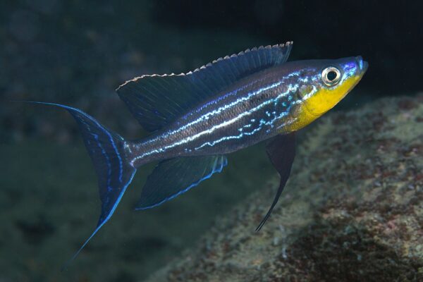
Lake Tanganyika boasts one of the richest freshwater ecosystems on Earth, with more than 1,500 species of plants and animals, including hundreds of fish species found nowhere else. The lake is particularly famous for its colorful cichlid fish, many of which have evolved into unique species over millions of years. Other important fish include Tanganyika sardines, catfish, tilapia, and various commercially valuable species that sustain local fisheries. Fishing provides employment, food security, and income for millions of people living around the lake. The remarkable diversity also attracts researchers, conservationists, sport anglers, and aquarium enthusiasts from around the world.
Lake Tanganyika Formation
Lake Tanganyika was formed approximately 9–12 million years ago through tectonic activity associated with the East African Rift System. As the African continental plates gradually pulled apart, a deep rift basin developed and eventually filled with freshwater from rainfall and surrounding rivers. This ancient geological process created one of the world’s oldest lakes, allowing millions of years for plants and animals to evolve in isolation. The lake continues to be shaped by ongoing tectonic movements, making it a valuable site for geological and climate research. Its ancient origin explains its exceptional depth, biodiversity, and unique ecological significance
Lake Tanganyika Gallery